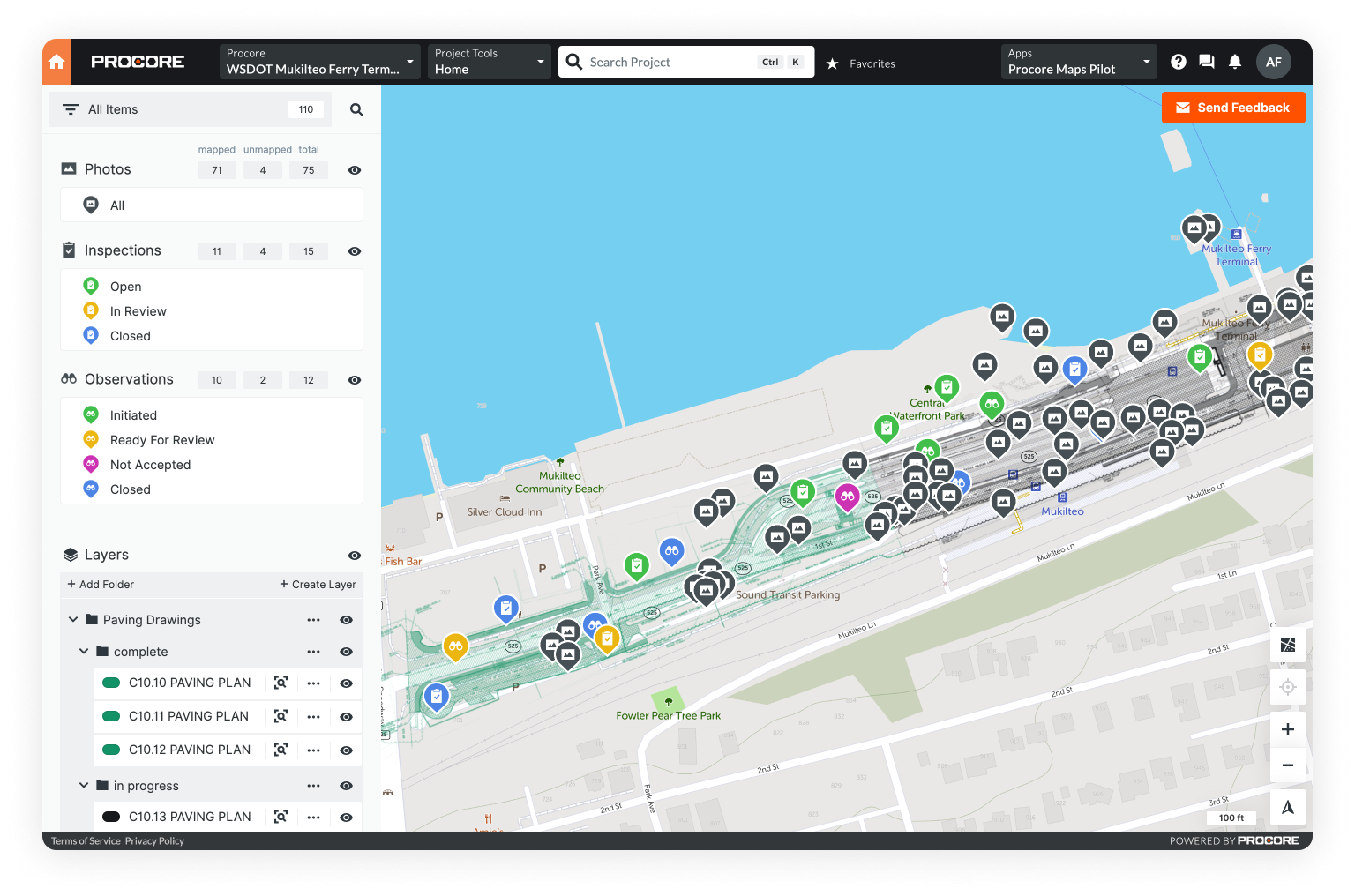
Improve visibility with geolocated drawings


The next generation of construction drawings
First, paper drawings went digital. Then, the field got access. But modern drawing management software still reduces the built world to a stack of files.
In contrast, geolocated drawings are pinned to real-world coordinates alongside other project data on a map - unlocking new insights while making it easy for a team to find what they need to get the job done fast.
Actionable data for construction and beyond
For many stakeholders, it just makes more sense to look at a geolocated drawing.
Whether that’s a superintendent in the field directing crews, a project manager assessing progress, or an engineer sharing updates with an owner.

Streamline your project with location-based insights

Track progress in real time
See exactly what has or hasn’t happened across your site, message team members, and monitor the status of ongoing work.
Build a collaborative team
Dissolve siloes by mapping a mixed dataset, exporting diverse file types, and using Procore, Bentley iTwin, and Trimble integrations.
Create accurate as-builts & improve owner communication
Leverage intuitive forms, drawing tools, and annotations to document redlines and create a comprehensive, easy-to-understand map.


Track materials with ease
Pin materials to your map and navigate the site with your phone’s GPS - showing your exact relation to assigned work.
Resolve disputes fast
Simplify the search for proof of work by emptying your folders onto a map and managing your data by location.
Enable advanced work packaging
Create assignments by linking documents, materials, and more on a map - easily navigable and digestible on any device.

An alternative to Google Earth in construction
There aren’t many software solutions out there built specially for large infrastructure projects. Google Earth wasn't designed with construction in mind, which is a major downside. Fortunately, there’s a more intuitive way to capture, manage, and share construction data: geolocated drawings.
Contextualize your data in one place
Standing on your job site, see your spatial relation to the work and associated documentation
Drawings
Get started by overlaying plans or blueprints on area maps and topographic data.
Photos
Capture photos onsite, bulk upload folders, or use an integration with Procore to automatically stream images. Either way, Unearth will instantly sort them by location and pin them against your drawing.
Drone surveys
Overlay orthomosaics captured on your site for up-to-date aerial imagery, progress tracking, stockpile measurements, and more.
Field documentation
Tie your documents (RFIs, inspections, permits, change orders, and more) to location, and use intuitive forms to collect new data.
GIS data
Easily share progress updates from OnePlace by exporting KML and ESRI SHP files to a legacy GIS system.
All file types
From Excel spreadsheets to PDF downloads, Unearth can store and georeference the file types that work for you.

.png)
.png)
.png)
.png)
Book a free consultation with an industry expert
Learn how Unearth's OnePlace equips teams with unparalleled visibility throughout the entire asset lifecycle