Oneplace for Oil & Gas

Manage miles of pipeline with clarity

Maximize your field operations across an expansive geographic footprint with OnePlace's map-based tools

a tablet showing an overpass under construction
Several field teams using Mobile GIS across critical infrastructure industries
Mobile GIS on a laptop showing a gas leak

Increase efficiency by connecting office and field

Complete inspections, optimize transportation routes, and monitor your sites in real time – all within one cloud-based solution.

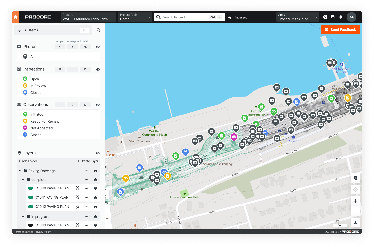
a point dropped on a mapeasy data access and integrationsa timeline of a project's progressreal-time review of a project on a desktop
  • Capture data in the field

    Capture photos, take measurements, manage tasks, and update your maps – all in the field. No wifi? No problem. OnePlace offers offline mode.

  • Use layers to build rich maps

    Layer terrain maps, aerial imagery, and data sets to gain new insights on your territory. Create from scratch or integrate from your legacy GIS. OnePlace accepts all GIS file types including KMZ, SHP, and GeoTIFF.

  • Manage tasks remotely

    Create a task directly within your map dashboard. Set a status and assign to a team member. View all tasks in the sidebar menu for an instant overview of what has or hasn’t been completed.

  • Receive updates in real-time

    Oil and gas sites are often in remote locations. With real-time updates, OnePlace helps information flow freely between field and office – no matter the distance in between.

a digitally connected oil & gas site


“I am proud to know that we can be more efficient with the task we have at hand. If we are not doing our job correctly then we can jeopardize a number of things. Now that we are using Unearth’s OnePlace, we have everything we need to make sure that the job is 100% done, every time.”

Rick Everett | Alabama Branch Manager
TeleVac Environmental

Features

Map annotation

Annotate aerial imagery, georeferenced drawings, and other map layers.

Geolocated documentation

Geolocate your project forms, photos, videos, audio, PDFs, and more.

Real-time project tracking

Get progress updates, manage work, and collect data on a real-time map.

Unlimited viewers

Add unlimited collaborators who can view and comment on your project.

Bentley, Procore, & Trimble R2 integrations

Map 3D models, auto-sync project photos, and capture high-accuracy GPS.

Offline mode & automatic data syncing

Equip the field with mobile-friendly tools on iOS, Android, or the web.

Easy import / export

Rapidly ingest and export CSV, PDF, KML, SHP, GeoJSON, and more.

Robust information security

Soc II Type II compliant software & secure AWS data storage.

Pricing

Unearth's OnePlace

$79 user / month

Start your trial

5 key applications for GIS in oil & gas

Geographic Information Systems (GIS) provide critical visibility and time-savings throughout upstream, midstream, and downstream operations. From well planning to emergency response, an easy-to-use GIS improves efficiency across miles of pipeline. See where you can benefit.

Read the industry report
satellite imagery of the earth

Book a free consultation with an industry expert

Learn how OnePlace's simple, digital tools increase efficiency throughout oil & gas operations

Thank you! Your submission has been received!
Oops! Something went wrong while submitting the form.

Explore OnePlace in other industries