Data collection is step one in a process or project designed to answer questions about the real world.
Data comes in many forms and is collected, as we’ll cover, in many ways. If data collection is step one, geographic information systems (GIS) are used to execute step two: analysis.
Analysis turns data - the basic building blocks of an answer - into understandable, actionable information.
The problem is that GIS data often isn’t freely available. It must be collected - an expensive process faced by a variety of challenges. Data collection challenges tend to fall into one of two buckets: dispersed data sources and location-limited Desktop GIS.
Mobile GIS can address both challenges.
New to Mobile GIS? No problem! Check out Unearth's comprehensive guide to the software.
This blog explores common data collection tools, roadblocks in the data collection process, and how Mobile GIS can address those challenges. Ultimately, it proposes a new approach to field data collection - one that harnesses the power of Mobile GIS.

Key Takeaways:
When you use Mobile GIS for data collection, you can...
1. Connect the field and office
Equip teams to collaborate remotely on distant projects.
2. Create a single source of project truth
Upload new data quickly from anywhere. Locate and access historical data with ease.
3. Streamline the data collection process
See updates in real time and easily communicate about next steps.
4. Save time and resources
Perform reviews as data is uploaded to identify and resolve issues quickly.
Overview of GIS Data Collection
GIS data collection has a broad range of applications and can be completed with a variety of methods.
That said, most data collection projects share the same fundamental framework:
1. Planning
Understanding and outlining project requirements.
2. Gathering resources
Obtaining paper maps, raster images, and relevant data sets.
3. Data capture
Using GPS devices, survey tools, remote sensing, aerial photography, and more.
4. Transfer / Digitization
Transferring data from field capture devices to the GIS, plus scanning any paper maps or raster images.
5. Evaluation
Identifying what went well and what could have gone better.
Data capture and transfer/digitization have the most potential for complexity. The next sections cover a basic framework for GIS data collection, as well as the many data capture devices.
Types of GIS Data Collection
There is a surprisingly wide array of data collection methods and devices.
Methods range from first-hand collection in the field, to scanning old paper maps using digitizers. As a result, some data is captured in a digital format with the express purpose of use for a GIS project while other data already exists and is then re-formatted.
With devices, the variety is ever greater. We cover the basic categories here, going into more detail in the next section.
Vector Data Collection
- GPS devices
- Surveying tools
- Toponymy surveys
- Toponymy data sets from atlases
Raster Data Collection
- Digital remote sensing
- Aerial photographs
- Scanned paper maps
- DEM’s from maps
Devices for GIS Data Capture
GIS data capture devices are a broad and varied category.
We’ll cover a variety of different devices: noting the data format (vector or raster), and the advantages/disadvantages of each device.

GPS ground surveys and LIDAR
Type: Vector
Advantages:
- Specifically designed for data collection
- Highly accurate
- Consistent device updates ensure increasing data quality
- Widely used and accepted
Disadvantages:
- Can be quite expensive (As accuracy increases, so does the cost)
- Requires specialized knowledge
- Data transfer requires special set-up and manual transfer

Remote sensors and drones
Type: Raster
Advantages:
- Consistent data
- More systematic support on a global scale
- Enables regular data capture cycles
Disadvantages:
- Poor resolution
- Interference from weather

Mobile phones
Type: Raster
Advantages:
- Most people already have and know how to use mobile devices
- Relatively affordable (compared to higher end GPS devices)
- Multi-functional
Disadvantages:
- Does not include workflows or native applications for data collection
- Limited device memory
- Best suited for capturing photos or videos
- Difficult to integrate with Desktop GIS

Paper maps and scanned maps
Type: Raster
Advantages:
- Affordable
- Simple to get started
- Easy to adjust based on project needs
Disadvantages:
- Difficult to manage and organize over the long term
- Increases risk of error and data loss
- Data transfer is slow and cumbersome
- Limited to a 2D format

Mobile GIS applications
Type: Vector and Raster
Advantages:
- Easy-to-use field apps for users unfamiliar with GIS
- Import / export of a mixed data set
- Real-time visibility & communication
- An entry point for organizations getting started in GIS
Disadvantages:
- Lacks the robust analytics tools of Desktop GIS
- Some software labels itself as “Mobile GIS” without delivering on their promise to connect office and field
The Challenges of GIS Data Collection
Having covered the basics of GIS data collection, it’s time to explore the two primary challenges of this complex activity:
1. Dispersed data sources
- Multiple devices are necessary
- Data is collected in different formats and file types
- Difficult to combine analog and digital data
2. Location-limited Desktop GIS
- Requires local installation on a single computer
- No access while in the field
With the wide variety of devices in the last section, dispersed data sources should make more sense.
End-to-end, most data collection projects require multiple devices - making it difficult to transfer and manage data effectively.
Once data has been collected, it must be uploaded to a Desktop GIS.
Desktop GIS is installed on a single computer and can only be accessed on that device. This is where the limitations of non-mobile software comes into play.

Dispersed data sources
Data coming from a single source tends to follow the same file format and transfer protocol.
In contrast, data coming from different sources experiences a wide degree of variation.
For example, a drone survey generally consists of hundreds, if not thousands of individual photos that are digitally stitched together - a process called photogrammetry.
Once survey stitching is complete, it must then be transferred to the GIS. From there it’s often superimposed on a reference or topographic map.
On the other hand, paper maps (another common GIS data source) require a completely different transfer protocol. These maps must be sourced from libraries or public records, and then digitized.
Drones and paper maps are just two examples.
Imagine if you needed to collect, re-format, and transfer data from all of the devices in the last section. This is the complicated reality of many GIS data collection projects.

Location-limited Desktop GIS
Once the data’s been collected, teams must import everything into the GIS, analyze and visualize (as the project requires), then export a deliverable.
Desktop GIS is fantastic at that second step: analysis. However, because Desktop GIS is installed locally - data import and export is limited to one location.
This has two practical outcomes:
1. Data import is slow
Imagine trying to transfer data from a handwritten letter into a cell phone, or from a film camera to a digital picture frame.
Both are possible, neither is easy.
Importing data from the field into a Desktop GIS can be similar. None of the devices “talk” to one another easily, and all have their own transfer protocol.
More than that, someone must be physically present, using the computer with GIS installed in order to initiate data transfer of any kind.
Potential data transfer methods:
- External hard drives
- Burning and shipping DVD’s
- Direct transfer - Plugging the device into your computer, converting files to SHP, and doing a drag-and-drop to the hard drive
In a world where digital connection is plentiful - cell phones, satellites, cloud computing, etc - this level of manual transfer is unnecessary.
The most widely used GIS platforms are still desktop-based, despite the fact that cloud technology enables data transfer and import in real-time.
2. Sharing deliverables is difficult
Once data is in the Desktop GIS, users can conduct spatial analysis, create visualizations, and build layered maps. Put simply, they create project deliverables.
Exporting deliverables from a Desktop GIS and sharing to an entire organization is its own challenge.
The primary roadblocks are file size, formatting, and again - the limitations of local installation.
File size and formatting are problematic because the common GIS file types - Shapefile (.SHP), GeoJSON (.GEOJSON), and GeoTIFF (.TIF) - are quite large and can often only be opened using a GIS.
Locally installed GIS means that, in order to share a deliverable, users must be able to access the computer on which the GIS is installed.
These factors effectively silo data within the platform, diminishing overall returns.
Fortunately, Mobile GIS addresses both dispersed data sources and location-limited Desktop GIS.
What is Mobile GIS?
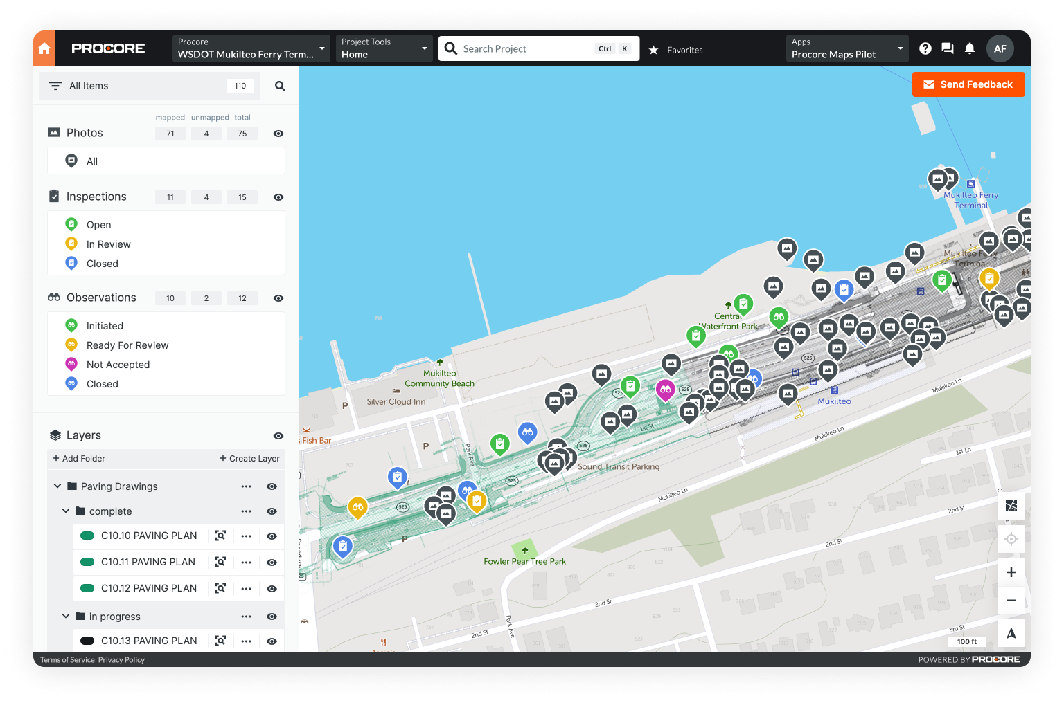
Mobile GIS can be accessed via any web browser. It can be used from anywhere, on any device - enabling data capture in a way simply not possible with Desktop GIS.
With Mobile GIS, users and organizations can:
- Import data from anywhere
- Make layered maps
- Manage location-based data
- Connect field and office teams
- Share deliverables quickly
- Make and view updates in real time
Mobile GIS doesn’t offer the same deep science and analysis tools as Desktop GIS - that’s not its purpose.
What it does do is streamline data collection: simplifying capture and transfer, improving communication between teams, and expediting final deliverables.
Streamline Data Collection with Mobile GIS

Collect and update in real time
With Mobile GIS, users can collect data into the GIS directly. Not only that, but data entered in the field updates across all devices in real-time.
Tools such as remote sensors and GPS will still play a role in certain projects. However, for many data collection tasks Mobile GIS is not only adequate, but more effective.
Mobile GIS enables real-time data review.
Analysts and project managers can view data as it’s collected by field teams. If there’s an issue, or more data is required, requests can be made immediately - rather than waiting for the team to return.
With direct capture and real-time updates, the entire GIS data collection process moves faster - a clear short term benefit. There are long term benefits as well.
Improve long-term data quality
Creating a single repository for all company data is the long-term benefit of Mobile GIS.
At first glance, that may not seem exciting, but look deeper and the value becomes clear.
One of the consequences of dispersed data sources is that data stays dispersed - even after analysis. Devices break, personnel changes, and in the long-term, data can simply disappear.
Mobile GIS provides a single repository for storing all current and historical data.
Easily accessible historical data can be especially valuable. Think of a common GIS activity like change detection. Without historical data, detecting change over time is impossible.
With fast data import and near unlimited data storage, Mobile GIS can become your de facto data repository with little to no effort.
Share deliverables quickly
Sharing deliverables is an important part of any GIS project. With Desktop GIS, the roadblocks to sharing deliverables are large file sizes, specific file formats, and the limitations of local installation.
Mobile GIS addresses these issues by enabling access to deliverables from anywhere.
If the deliverable was created within the Mobile GIS, it can be viewed or shared at any time. If the deliverable was created within a Desktop GIS, it can easily be transferred to the Mobile GIS.
With Mobile GIS, users simply have more options. They can review data in the app, share deliverables with a link, or download files to the format of their choosing.
In summary, Mobile GIS streamlines data collection:
- Connecting dispersed data collection devices
- Receiving updates from the field in real time
- Creating a single repository for storing all current and historical data
6 Steps to Implement Mobile GIS

1. Identify key stakeholders within your organization
First, identify significant project managers, field personnel, and GIS analysts within your organization.
Reach out to each person in turn and broach the subject of integrating a Mobile GIS platform. Address any concerns and outline the benefits of Mobile GIS integration.
Enthusiastic internal advocates will be extremely helpful throughout this process, so make sure to give this step adequate time and attention.
2. Layout your current data collection process
Map out your organization’s process for collecting, managing, and analyzing GIS data. Start with the planning phase, charting through each step to evaluation.
Be sure to consider personnel needs, necessary software and hardware, average time spent, and total cost per step.
Calculating cost per step is essential because it provides a baseline for operational efficiency. Use these numbers to create projections and determine average potential savings per project and per annum.
This is critical because it provides hard data about the value of investing in Mobile GIS.
3. Research and evaluate Mobile GIS software providers
Many organizations make the mistake of trying to build an in-house GIS solution.
Building a functional, user-friendly Mobile GIS requires specialized skills and a dedicated software team. The resources needed to develop a truly useful tool in-house will quickly outweigh any potential benefits.
Finding a Mobile GIS that is already developed with regular updates and support, lets you get started in weeks (as opposed to years) - at a fraction of the cost.
When comparing Mobile GIS providers, create a spreadsheet of available options. Make sure to include cost, licensing structure, features, and support.
4. Reach out to your top three options
Contacting each provider before purchasing is important. You can discuss the numbers and processes laid out in steps one through three, and evaluate each option on a more personal level - kind of like a job interview.
Ultimately, integrating your new Mobile GIS will be much easier if you choose a provider who offers a certain level of customization, onboarding, and specialized support.
A one-on-one conversation is the easiest way to ensure your new partner can provide these services.
5. Make a decision and get buy-in
Once you’ve decided on a platform, it’s time to nurture and manage organizational buy-in. This is where the work done in step one becomes particularly important.
Depending on your organization, this is potentially the most difficult or time-consuming step. Fortunately, the vendor you choose should be able to help.
Ideally, your vendor should be able to provide materials that present their product to your organization. Some companies will even fly people to your company for onboarding and training, so be sure to ask if that’s a possibility.
6. Roll it out
Once everything is in place, you’re ready to get started.
Work with your provider to create an implementation plan. They should have a system in place for getting new clients up and running on the platform.
Each team within your company should have a detailed set of expectations in terms of how and when they will use the software. They should also have fast access to a member of the provider’s support team.
These steps are a general outline that will help your organization transition smoothly into using a Mobile GIS. Try to remember that change can be a long, slow process. Stay optimistic and remember how this transition will benefit your organization.
Get started with Mobile GIS
Effective data collection and management requires a new standard for GIS - one that’s mobile-friendly and designed around the capabilities of modern cloud computing.
Unearth has spent the last few years building an easy to use, cloud-based GIS, designed specifically for built-world industries: OnePlace. When we realized the need for a platform that expanded the potential of Desktop GIS, we knew we could provide a solution.
We believe in the awesome power of GIS, and we’re excited to help construction, utilities, oil and gas, telecom, water, and more, move towards a solution that works for boots on the ground.