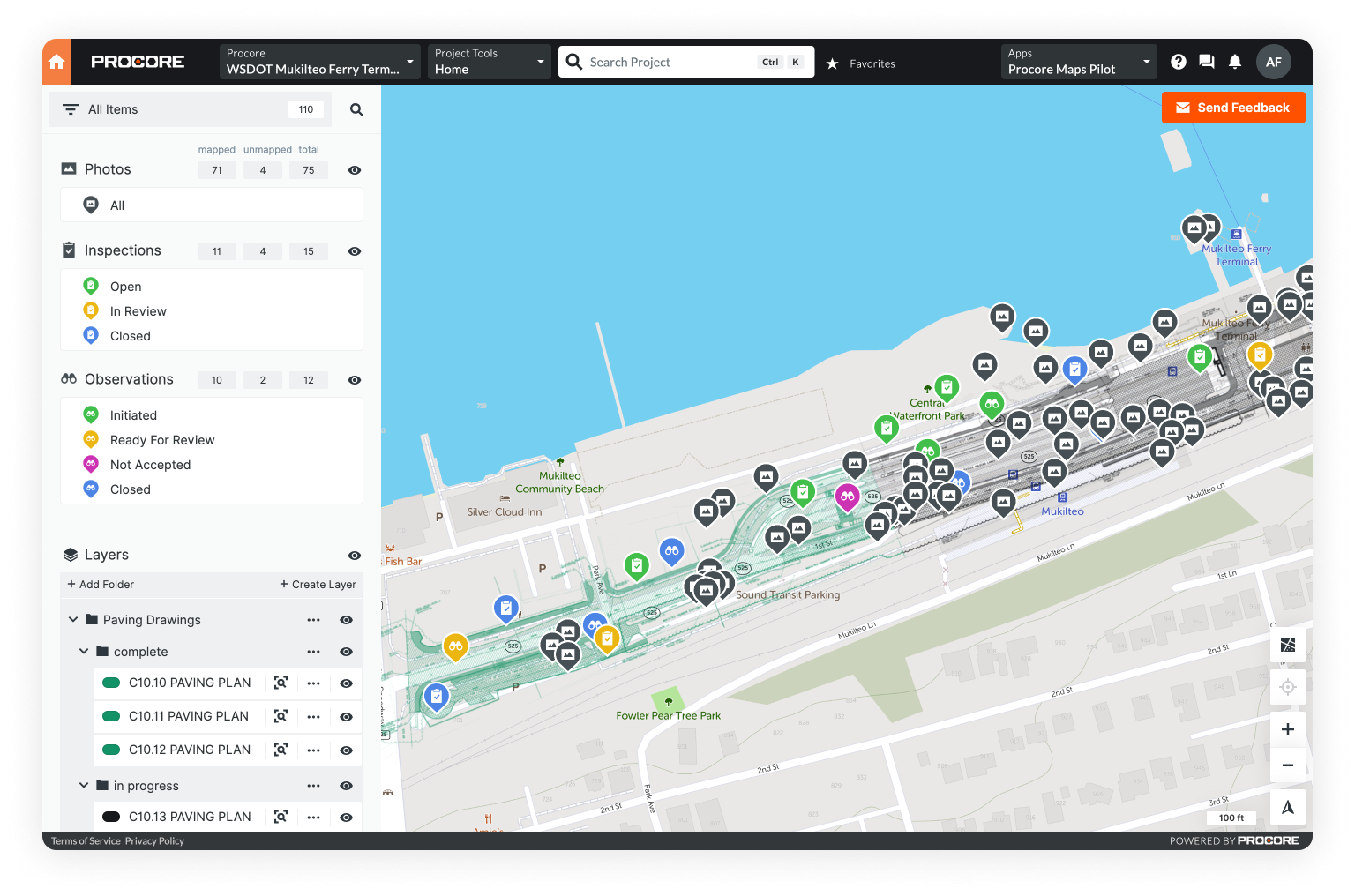
GIS software comes in two general formats: open-source and commercial.
Open-source GIS software is free and the source code is openly available - meaning anyone can study it and/or make changes. In most case, free GIS software doesn't have the same functionality and support as commercial GIS. That said, some open-source options are still quite powerful.
In contrast, commercial GIS involves a paid subscription or a one-time per user fee. These platforms tend to offer more updates and greater functionality, but the top tier options can be quite expensive.
Looking for more GIS software options? Explore different GIS software types in our blog Intro to GIS: What It Is and How to Get Started.
Open-source GIS software is a fantastic option for organizations on a budget or anyone looking to learn GIS without a huge financial commitment. Though free GIS platforms don't offer full feature parity, many are still quite robust: capable of performing a large variety of geospatial mapping and analysis tasks.
Below, we cover the best free GIS mapping software available including ratings, features, mobile capabilities, and primary use cases.
QGIS

Best for
- A free, functionally comparable alternative to ArcGIS
Top 3 Features
- Consumes all data types
- Advanced cartography tools
- Huge plugin library extends functionality
Ratings round-up
- FinancesOnline: 4.5/5
- GIS Geography: 4/5
Type
- Desktop
Mobile capable
- No
Overview
QGIS is perhaps the only free GIS platform that’s effectively comparable to ArcGIS.
Use it for basic GIS tasks like map production and geospatial analysis, as well as more specific tasks like disaster risk reduction, terrain analysis, and environmental resource mapping.
The interface is fairly similar to ArcGIS, which allows experienced GIS users to jump in quickly and customize their tools and plugins. QGIS can also integrate with other open-source GIS systems to extend its functionality.
QGIS gets high marks for its ability to automate map production, generate cartographic figures, and process geospatial data. As an added bonus, users can view, edit, and analyze their geospatial data in both vector and raster format.
Whitebox GAT

Best for
- Advanced geospatial data analysis
Top 3 Features
- Excellent for LiDAR data
- Storm surge, hydrodynamic, and shoreline mapping
- Remote sensing software package
Ratings round-up
- G2: 5/5
- GIS Geography: NA
- Capterra: NA
Type
- Desktop
Mobile capable
- No
Overview
Whitebox GAT excels at advanced geospatial data analysis, and has applications in both environmental research and the geomatics industry.
One unique feature is Whitebox GAT's ability to manage LiDAR data, which is useful for accurately examining natural and manmade environments.
Whitebox GAT replaced the Terrain Analysis System tool for hydrogeomorphic applications in 2009. In that short time it has become surprisingly fine-tuned and is now a fully developed, open-source GIS platform.
Though the cartographic tools aren't as developed as a platform like QGIS, the LiDAR capabilitities - such as LAS to shapefile conversion - make Whitebox GAT one of the more unique and useful softwares on this list.
SAGA GIS

Best for
- Automated geoscientific analysis
Top 3 Features
- Easy and effective implementation of spatial algorithms
- A comprehensive, growing set of geoscientific methods
- Approachable user interface with many visualization options
Ratings round-up
- GIS Geography: 3.4/5
- SourceForge: 5/5
Type
- Desktop
Mobile capable
- No
Overview
SAGA, System for Automated Geoscientific Analyses, is one of the best regarded GIS softwares on this list.
This platform specializes in geoscientific analysis. It's capable of processing LiDAR data and offers 3D visualization - a relative rarity for open-source GIS.
With powerful toolsets for raster processing, terrain analysis, and geoscientific data analysis - SAGA is a favorite among those working on more technical geoscience projects.
SAGA also offers geostatistics tools. With regression analysis and semi-variograms, users can engage in various predictive exercises. Despite the complexity of these processes, users report that the simple user interface makes these tasks relatively straightforward.
Though the cartographic functions within SAGA aren't particularly well developed, the unique geoscientific toolsets more than make up the difference.
GRASS GIS

Best for
- Land management and environmental planning
Top 3 Features
- Advanced image processing
- Specializes in terrain manipulation
- Robust tools for raster and vector analysis
Ratings round-up
- G2: 4.2/5
- GIS Geography: 3.9/5
- FinancesOnline: 3.9/5
Type
- Desktop
Mobile capable
- No
Overview
GRASS stands for Geographic Resources Analysis Support System. This platform offers advanced geoprocessing tools and is used primarily for land management and environmental planning.
GRASS GIS is a favorite in the academic community. Its code base is easy to inspect and manipulate, meaning it can be tailored to fit specific projects.
Featuring over 350 geoprocessing tools, GRASS specializes in raster and vector manipulation, but is also capable of image processing, graphic production, and data visualization.
Though aspects of GRASS are more developed than your average open-source GIS, it does have a few downsides. Primarily, an unintuitive user interface and clunky cartographic tools. Though it's possible to create maps, users report the process is quite difficult and, given the availability of other more effective options, not worth the trouble.
That said, for terrain analysis and geoprocessing, GRASS is difficult to beat. Developed by the U.S. Army, it is still used today by agencies like NASA and the USDA.
gvSIG

Best for
- 3D mapping
Top 3 Features
- Animation and 3D mapping
- Raster and remote sensing
- Vector representation
Ratings round-up
- G2: 3.8/5
- GIS Geography: 8/10
Type
- Desktop
Mobile capable
- Yes
Overview
gvSIG was developed in Valencia, Spain and released for public use in 2004.
GIS Geography, a popular GIS publication, actually prefers gvSIG to QGIS for 3D mapping, calling it the best open-source 3D visualization tool available.
gvSIG boasts the largest network of open-source integrated geomatics on the web. It is also quite easy to use, allowing users to create layouts and access geoprocessing networks without advanced technical knowledge.
With 3D visualization, users can view all layers as rasters or 3D vectors, all togehter or one-by-one. With impressive OpenCAD tools, gvSIG users can trace geometries, snap and split lines, edit vertices, and add polygons.
NavTable, one of the most popular gvSIG plugins, enables users to navigate within the map by selecting data sets. Click a specific table within the data set and the data from that table with automatically highlight within the map or visualization.
gvSIG is one of the only open-source GIS platforms with a native mobile app for Android. This makes it a great option anyone who needs to collect data or create maps in the field.
OpenStreetMap

Best for
- A free easy-to-use alternative to Google Maps
Top 3 Features
- Community-built mapping service
- Continually updated
- More detailed and up-to-date location information
Ratings round-up
- G2: 3.8/5
Type
- Desktop
Mobile capable
- Yes
Overview
OpenStreetMap (OSM) is a community-driven platform, developed by "mappers" throughout the world.
With decent cartographic capabilities but no geospatial analysis tools, this platform is fairly basic compared to the other free options on this list.
That said, it's also very straightforward and easy to use - perfect for novice map makers. Popular among outdoor enthusiasts, OSM is often used to digitally map hiking trails.
Public contributors continually update the system with fresh information about roads, railways, trails, and other points of interest all over the globe.
No approval process is required to make updates to the map, so whatever a user adds will be immediately visible to the community.
OpenJUMP

Best for
- JAVA users
Top 3 Features
- Open API and plugin system
- Ability to customize the appearance of your information
- Editing geometry and attribute data
Ratings round-up
- G2: 3.0/5
Type
- Desktop
Mobile capable
- No
Overview
OpenJUMP is a community-driven GIS mapping software. JUMP refers to "Java Unified Mapping Platform.”
A key feature of OpenJUMP is its ability to read and edit geometry. Users can use OpenJump to analyze data, read and write shapefiles, interpret vector formats, and connect with external spatial databases.
OpenJUMP can handle large data sets and works well for visualizing data through plots, pie charts, or choropleth maps.
Visual rendering on OpenJUMP is above average and the platform offers several mapping options. With plugins, users can manipulate rasters, employ large-scale databases, and conduct spatial analysis.
uDIG

Best for
- Basic mapping
Top 3 Features
- User-friendly drag and drop interface
- Import base maps, similar to ArcGIS
- Works as an extension of other systems
Ratings round-up
- GIS Geography: 4.9/10
Type
- Desktop
Mobile capable
- No
Overview
Break down the acronym uDig and you can easily understand the platform's capabilities.
u – User-friendly interface
D – Desktop (Run uDig on Windows, Mac, and Linux)
i – Internet-oriented consuming standard: including WMS, WFS, or WPS
g – GIS ready for complex analytical capabilities
uDig is best for basic GIS mapping and specializes in forest management and biodiversity projects. It's capable of base map import and features a drag-and-drop interface, editing tools, and vector operations.
Built with Eclipse Rich Client (RCP) technology, uDIG users can engage in complex data analysis within a user-friendly framework.
This open-source platform works as an independent application or as an extension of other RCP plugins.
Compared to other options here, the uDig community is smaller, meaning updates are less common. That said, the documentation is robust and in terms of GIS basics, uDIG has a lot to offer.
Conclusion
There you have it! Our top eight picks for the best available free GIS software. No matter what functionality you’re looking for, there's likely a platform out there that will suit your needs.
If you've tried the free options and are looking for more support and functionality, try Unearth's OnePlace. Our platform is cloud-based, easy-to-use, and designed for critical infrastructure industries.
Intimidated by GIS?
No problem. Unearth offers a nimble solution, OnePlace, for simple mapmaking, multimedia geolocation, and intuitive data collection. Get started in GIS by mapping the data you already have - spreadsheets, photos, and more.

Want to continue your GIS journey?
Check out our blogs on learning GIS and GIS's role in critical infrastructure like telecom or oil & gas.