Unless you’re reading this from a tent in the forest, you're likely in an area that was developed by an urban planner. Urban planning is the process of both developing and designing open land, urban areas, and the built environment.
Urban planning is a multi-faceted process involving infrastructure, utility systems, communication networks, distribution chains, and more.
Managing so many variables can be challenging, but modern GIS technology provides a solution.
New to GIS? Get a grasp on the fundamentals with our simple guide Intro to GIS: What It Is and How to Get Started.
What is Urban Planning?
Urban planners, sometimes known as city planners, design cities and create plans for future improvements and growth. These plans include much of what you see when moving through an urban environment: streets, parks, public spaces, and more.
According to National Geographic, urban planning dates back to the 19th century when illnesses ran rampant through dirty, overcrowded cities. City planners deduced that situating people far from industrial centers, foul odors, and pollution would improve public health.
It was during this time that zoning ordinances came into effect: separating urban areas into residential, business, and industrial districts.

Some argue that, though there may have been health benefits, moving people further from their jobs increased reliance on cars: increasing traffic and air pollution. As such, modern city planning must consider things like bike lanes, walkability, and traffic flow.
While early city planners were generally concerned with rapid population growth and urban sprawl, modern urban planners are faced with the opposite issue. Most cities are not growing. In fact, many are facing population loss.
The 2010 U.S. Census indicated that population growth had slowed in 14 of the 15 largest urban centers. Urban planners, therefore, must also plan for what to do with the vacant land created when people or businesses move away.
Urban planners do their best to plan for an unpredictable future.
Fortunately for today’s urban planners, technology has advanced in a way that can help. Geographic information systems (GIS) have become an invaluable tool for urban planners, providing support for database creation, spatial analysis and modeling, and visualization.
Benefits of GIS in Urban Planning
GIS in urban planning is becoming increasingly useful over time.
Initially, the high costs of installation and operation stunted the adoption of GIS in urban planning. However, as GIS hardware became less expensive and GIS software became more user-friendly - adoption has increased.
There are numerous benefits of using GIS in urban planning, but here are the top five.
1. Improved mapping
With a single repository for current and historical data and maps, GIS can improve map currency (whether or not a map is up-to-date), increase the efficacy of thematic mapping, and lower expenditures for data storage
2. Increased access to vital information
Desktop GIS makes it easier to store, manage, and access data from a variety of sources. Cloud GIS offers that same benefit, while enabling access from any device.
3. Improved communication
With a unified system for data storage and management, internal parties can access the information they need immediately - rather than sifting through documents, hard drives, or trying to track down data across departments.
4. Increased quality and efficiency for public services
GIS can be used to create a public facing portal (like this one), opening the flow of information between government organizations and the public. Government officials can share information quickly, while members of the public have self-serve access to the information they need.
5. Increased support for strategic decision making
With speedier access to a wider ranger of important geographic information, planners can create informed strategies more effectively. More than that, they can explore a wider range of 'what-if' scenarios - ideally leading to stronger, more effective long-term strategies.
How does GIS achieve these benefits? Let’s take a look.
GIS Tools for Urban Planning
GIS platforms have a variety of capabilities that can be applied to urban planning. Database management, visualization, spatial analysis, and spatial modeling are among the most widely employed. Let’s take a quick look at each.

Database management
Database management is the process of creation, import, maintenance, and use of all data traveling in and out of a GIS platform.
For urban planning, this involves the storage of environmental data, socioeconomic data, land use maps and plans, and planning applications.
As you can imagine, cities produce huge quantities of data in many different formats. GIS provides a single database where all that data can be stored and easily organized. Once data has been added to the database, urban planners can use spatial queries to quickly access the information.

Visualization
In the context of urban planning, visualization often refers to maps.
Desktop GIS offers powerful mapping visualization tools, enabling planners to create maps (sometimes even in 3D). Environmental and socioeconomic data can be used to help create these maps, or added after the fact as a secondary data source.
Digital maps make it easier for urban planners to make decisions and explore solutions. For example, identifying an ideal location for a new park or public space.

Spatial analysis & modeling
GIS in urban planning enables spatial analysis and modeling, which can contribute to a variety of important urban planning tasks.
These tasks include site selection, land suitability analysis, land use and transport modeling, the identification of planning action areas, and impact assessments.
GIS functionality such as interpolation, buffering, map overlay, and connectivity measurement help urban planners to achieve these tasks.

Field data collection
For many years, people associated GIS with bulky software installed locally on desktop or laptop computers in the back office. This is changing.
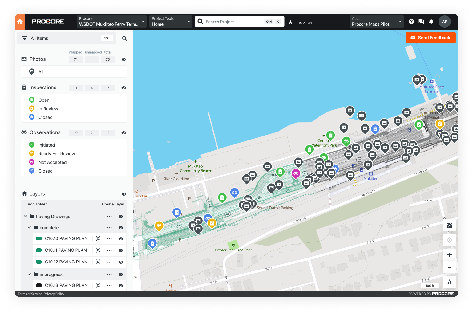
With the advent of Mobile GIS, urban planners can conduct research in the field, view dynamic maps on their phones, capture key information, and import field data back into a Desktop GIS.
Practical Applications of GIS in Urban Planning
Let’s breakdown the various practical applications of GIS in urban planning.
Resource inventory
GIS platforms, especially those used in conjunction with remote sensors, decrease time spent collecting land-use and environmental information. With remote images, urban planners can detect current land use, as well as changes to land use for an entire urban area. These images can also be used to create compelling visualizations with 3D CAD models.

Creating land-use maps & plans
Future land-use maps act as a community’s guide to future infrastructure, build plans, and public spaces. These maps help ensure that a city’s urban planning accounts for environmental conservation, pollution, mitigating transportation issues, and limiting urban sprawl.
With GIS, urban planners can quickly create maps of the city as it is today, and then use various modeling and predictive data techniques to explore scenarios for the future. Ideally using this exercise to create a future land-use map that is thoughtful, sustainable, and sound.
Planning applications
GIS can help the government and businesses process and organize planning applications.
Many GIS portals can be made public facing, which means citizens can access data such as parcel outlines and information, county/district boundaries, and area zoning. With vital information more widely available to all, government resources (which might have been spent fielding these requests and finding the data) can be put to use elsewhere.
Moreover, with all the applications stored in a central database, organization, processing, and status tracking becomes much simpler.
Analyzing socioeconomic & environmental data
Creating future land-use maps must take into account several environmental scenarios, as well as project future demand for land resources. Modeling must include population data, economic activities, and spatial distribution.

The visual component of GIS makes analyzing location-based data (like socioeconomic and environmental trends) simpler and more effective. GIS enables the creation of thematic maps i.e. maps that combine data and location in order to explore correlation and display trends.
With the various data sets stored in the GIS database, users can create layered images that include topography, street maps, thematic maps, and more - helping to easily identify ideal spaces, as well as areas of potential conflict.
Land suitability analysis/site selection
GIS tools like map overlay enable urban planners to conduct land suitability analysis, an important step in site selection.

Remote sensing, spatial queries, and environmental data analysis help urban planners find areas of environmental sensitivity. By overlaying existing land development on land suitability maps, they can identify any areas of conflict between the environment and potential development.
Measuring connectivity
GIS geoprocessing functions like map overlay, buffering, and spatial analysis help urban planners to conduct connectivity measurement.
Connectivity refers to how easy it is to walk or bike in a given city. A highly-connected area will give its residents numerous options to get from A to B quickly.
Impact assessments
An environmental impact assessment can be conducted to evaluate the potential effects urban development will have on the environment. If issues are found, the urban planner can then recommend ways to alleviate or mitigate negative outcomes.
Evaluation, monitoring, & feedback
GIS tools can help evaluate a building plan, monitor the project after completion, and even gather feedback to help make improvements.
Together with remote sensing, GIS can help planners to track if development is following the area’s land use plan. It can also help them evaluate impact and suggest adjustments - if required.

Case Study: Utilizing GIS for Urban Planning in Kigali, Rwanda
Below we summarize a fascinating case study on the use of GIS to stabilize urban planning in Kigali.
As the capital of Rwanda, Kigali is a densely-populated city - one that has experienced rapid growth in recent years. The current estimated population is 1 million, but with a growth rate of 9 percent - population is expected to double in the next 10 years.
Due of this rapid growth, development of the city has been rather haphazard. With no plan in place to guide development, significant issues and challenges have arisen.
The Kigali Urban Planning and Management Capacity Building (KUPMCB), an offshoot of the urban development project of the United Nations Development Program (UNDP), was faced with the task of creating an articulate master plan for developing select zones and ensuring environmental sustainability.

To achieve this goal, KUPMCB employed GIS tools to do the following:
Create an inventory - Including all available maps and plans with title and scale, as well as an inventory database with any maps related to urban planning and environmental issues.
Create a digital basemap - KUPMCB was then tasked with digitizing all of the existing maps in order to create a master digital basemap. This map included landforms, gridlines, road networks, hydrographic networks, built up areas, a legend, and a general city layout.
Research and field work - The team then went into the field to gather additional data and any missing information: conducting a traffic flow study and a socioeconomic data survey.
Conduct aerial surveys - Used to update and add data to the basemap
Create thematic maps - Combining data gathered in the field with other data, they were able to generate two thematic maps - a constraints map and an existing land-use map.
Develop a suitability map - Giving options for potential development areas using map overlay operations.
Summary
GIS helps urban planners to develop the towns and cities we live in, prepare for future developments, and make adjustments as the population in an area changes. An important and useful tool, GIS has become invaluable for many when it comes to effective urban planning.
Get started with mobile GIS
There are many opportunities to learn GIS, but back-office systems often require a degree and technical training. With this in mind, Unearth built OnePlace - a great way to start exploring the power of GIS on any device, without diving into the deep end.