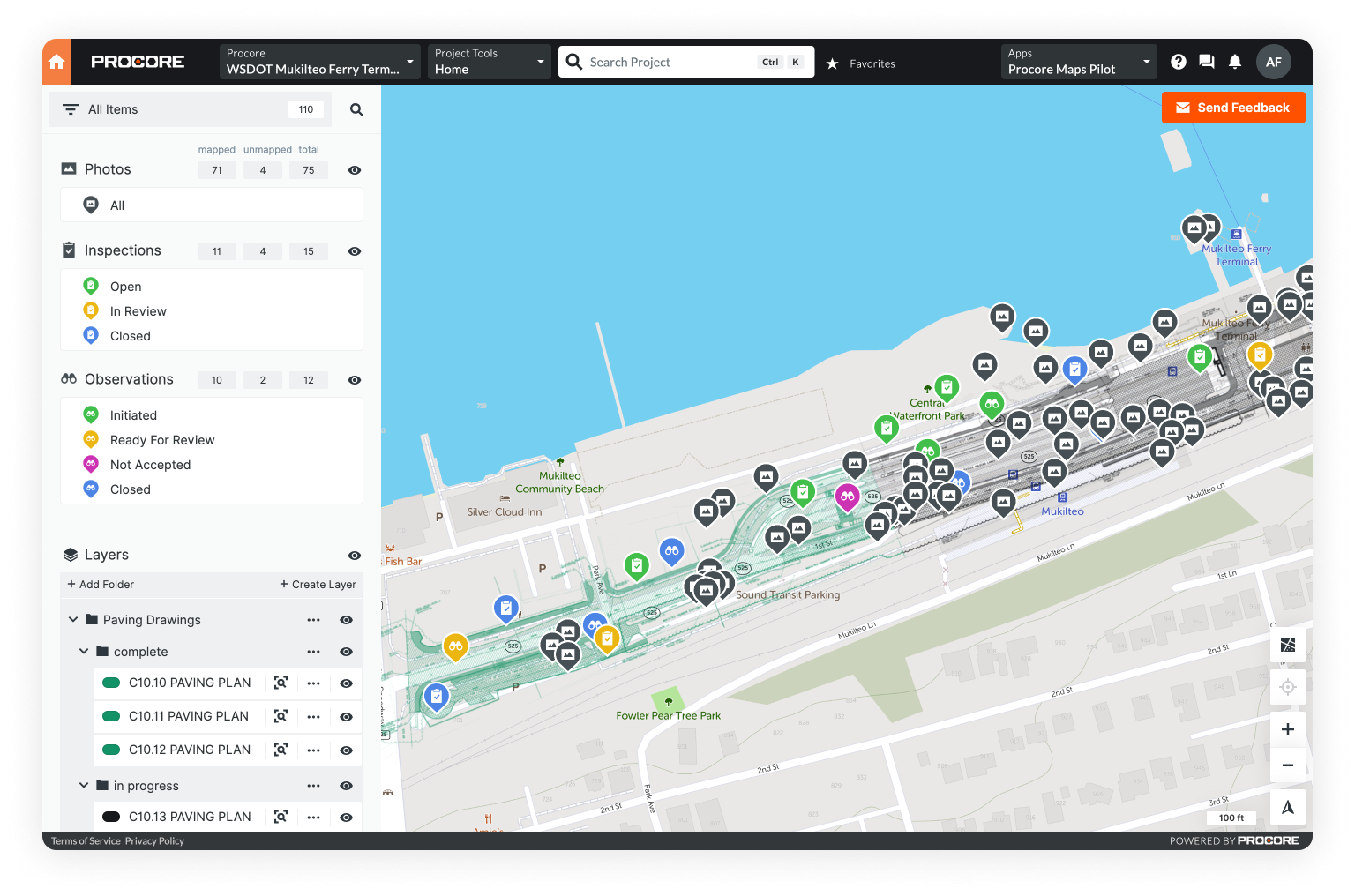
ONEPlace for Emergency Response

Real-time visibility when every second counts

Connect your command center and field responders with the digital tools they need to manage an emergency

a tablet displaying a utility field crew repairing power lines

Use OnePlace in Emergency Response to...

a desktop displaying critical information

Make context-based decisions

Optimize dispatches with a rich map of assets, incidents, and work

multimedia geo-located on a map

Collect data from anywhere

Rapidly assess damage and capture dynamic field conditions

an alert displayed on a map

Monitor incidents in real-time

Track incidents and assign tasks with unparalleled visibility

three stakeholders sharing critical information in the field

Collaborate with stakeholders

Share data seamlessly between municipalities and mutual aid partners

Turn any device into a digital command center

a staging site depicted in a Mobile GIS on a tablet

Illuminate complex logistics

Trade whiteboards, paper spreadsheets, and analog tools for a dynamic, real-time map. Consolidate lodging, staging sites, equipment, personnel, and more - all in one place.

Deploy next-generation data collection

Cut response times by equipping field responders with simple, digital tools. Record damage instantly, geotag multimedia to assets, and visualize progress - improving productivity, anywhere in the field, on any device.

a tablet and laptop displaying a damage assessment in a Mobile GIS
a desktop displaying in-app work management in a Mobile GIS

Leverage real-time situational awareness

Reduce errors and optimize every dispatch by sharing data seamlessly with municipalities and mutual aid partners. Plus, notify workers based on location, and create robust documentation in minutes.

Features

Multi-layered maps

Annotate aerial imagery, plans, GIS, and other map layers.

Geospatial awareness

Geolocate your project forms, photos, videos, audio, PDFs, and more.

Real-time project tracking

Get progress updates, manage work, and collect data on a real-time map.

Unlimited viewers

Add unlimited collaborators who can view and comment on your project.

Unlimited cloud storage

Manage large teams and data uploads in the field and office with cloud storage.

Offline mode & automatic data syncing

Equip the field with mobile-friendly tools on iOS, Android, or the web.

Easy import / export

Rapidly ingest and export CSV, PDF, KML, SHP, GeoJSON, and more.

Robust information security

Soc II Type II compliant software & secure AWS data storage.

Pricing

Unearth's OnePlace

$79 user / month

a city street and bicycle covered in snow and ice

Effective data sharing, when it matters most

Whether it's a wildfire, tropical storm, or gas leak - OnePlace helps you manage complex logistics, conduct rapid damage assessments, and connect everyone to the data they need.

Find your industry

Questions about OnePlaceTM?

Give us a call at 206.257.2682 or fill out the form below and we'll be in touch.

Thank you! Your submission has been received!
Oops! Something went wrong while submitting the form.